Fleet Geofencing Software that tracks every move
Fleet geofencing software lets you create virtual zones around your depots, warehouses, customer locations, toll plazas, and restricted areas. Fleet Scanner sends instant alerts whenever a vehicle enters, leaves, or stays too long in a zone. You also get a complete history of visits, time spent, and violations, so you always know what is happening at every location without making a phone call.
Get Free Demo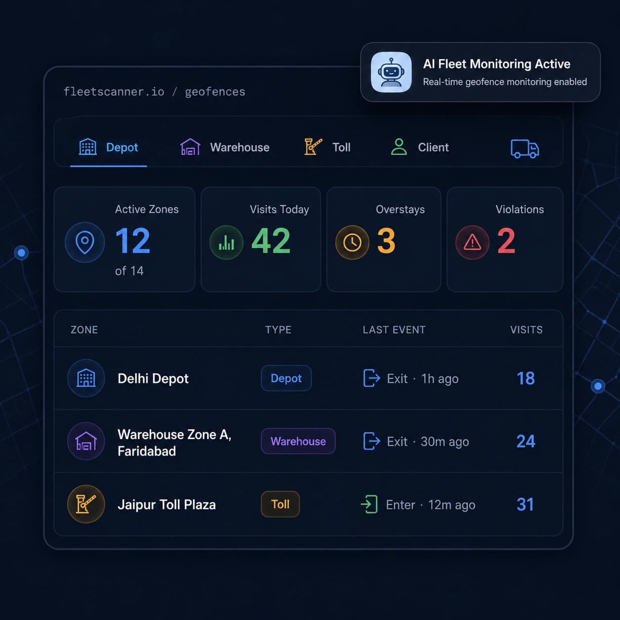
Fleet Geofencing Software For Visibility Into Every Location
Did the truck really reach the customer? How long did it stay at the warehouse? Did it enter an area where it shouldn’t be? Without geofencing, you often have to rely on driver updates, which may be late or incomplete. This can lead to extra costs, long delays, and missed information.
Unverified arrivals
You depend on the driver to confirm they arrived and left on time, but there is no automatic proof.
Unseen overstays
Vehicles can spend hours waiting at warehouses or customer sites without anyone noticing.
Restricted-zone entries
A vehicle may enter a restricted or dangerous area without the operations team knowing.
Detention disputes
Without records of how long a vehicle stayed at a location, it becomes difficult to prove delays and recover detention charges.
Smart zones, instant alerts, and complete location records
Fleet Scanner Geofencing Software turns important locations into smart geofences that automatically monitor vehicle movement, send alerts, and keep detailed records of every visit.
Zone for every important location with fleet geofencing software
Geofencing software lets you draw an invisible line around any place that matters to your business. Each zone can have its own rules, alerts, and settings for watching it.
- Depot: See every vehicle move in and out of the yard or parking area
- Warehouse: Watch loading, unloading, and storage activity
- Client Site: Know exactly when vehicles arrive and leave
- Toll Plaza: Set up as a stop along the route
- Checkpoint: Watch key stops and waypoints along the way
- Hazardous Area: Get an instant alert if a vehicle enters a restricted zone
Know exactly when vehicles move
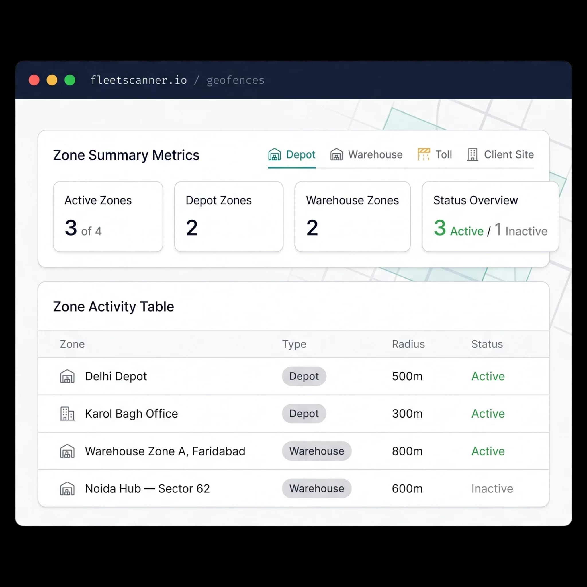
Fleet Scanner's geofencing software sends a real-time alert the moment a vehicle enters a zone, leaves a zone, or stays longer than it should. This lets your team react right away, without having to call the driver to ask what's going on.
- Instant alert when a vehicle enters any zone
- Instant alert when a vehicle leaves any zone
- An alert if a vehicle stays too long (an overstay)
- Every alert goes straight to your central dashboard
Keep a record of every visit
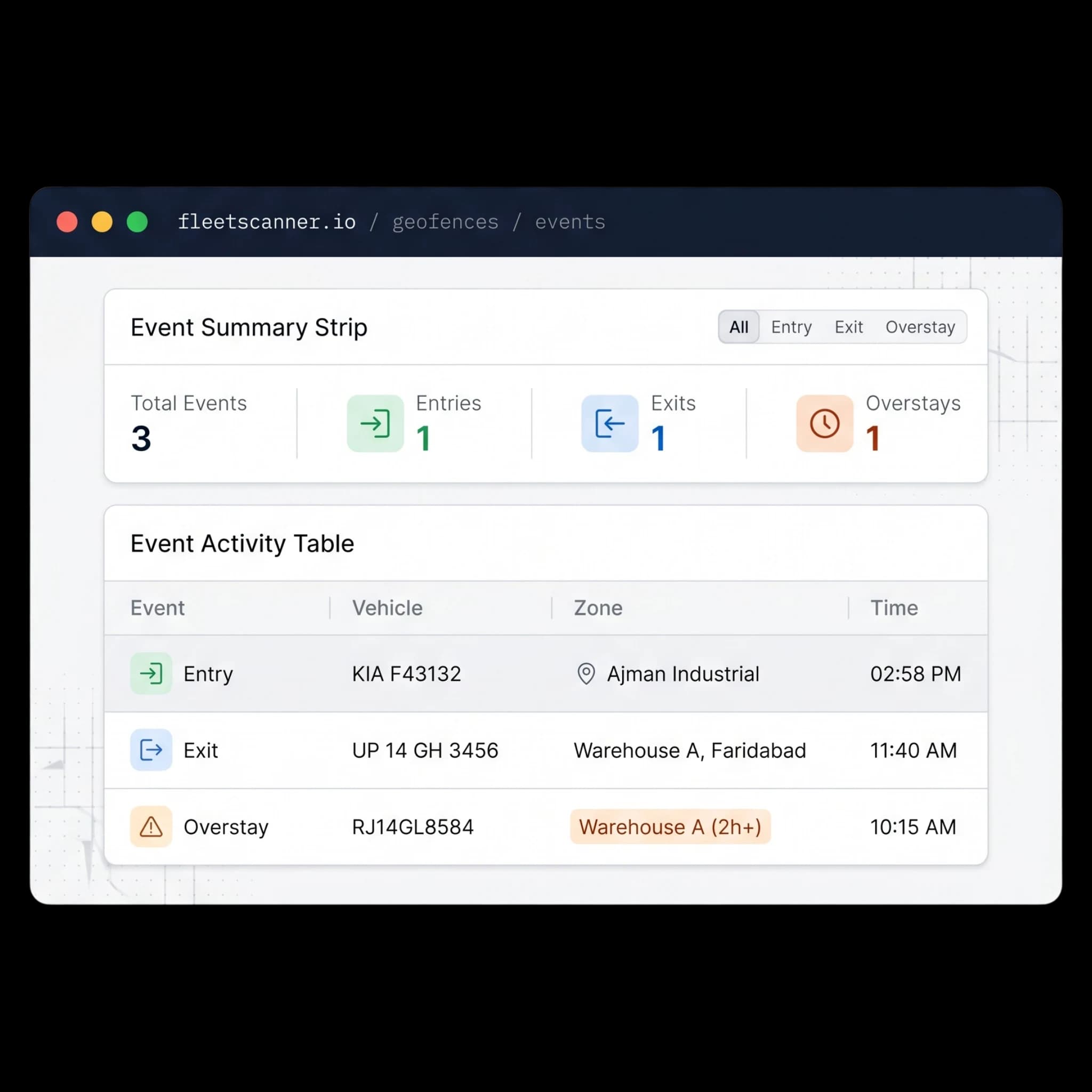
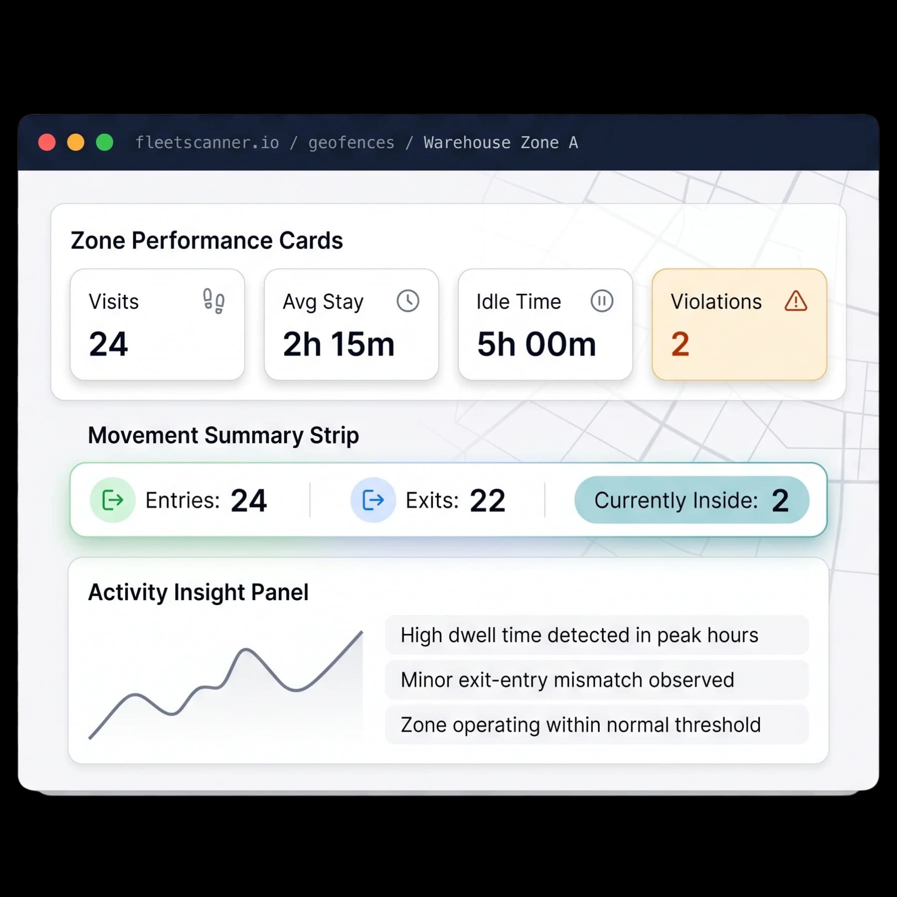
Every geofence keeps a detailed record of vehicle activity, including entries, exits, how many times a vehicle visited, and how long it stayed there.
- Full entry and exit history for every zone
- Total visit count and average time spent
- Idle time and rule-break tracking
- Time-spent reports to support detention claims
Use geofences as route checkpoints
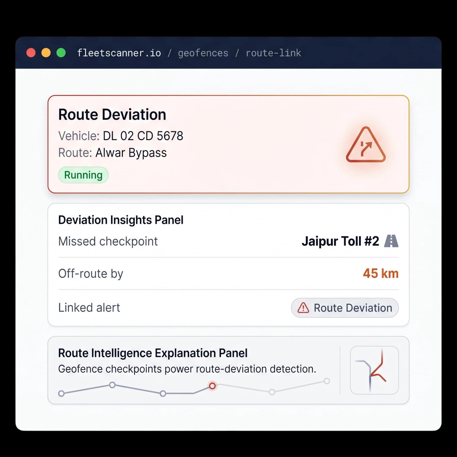
Geofences can also work as checkpoints along a route. If a vehicle skips a checkpoint or wanders off the planned route, Fleet Scanner sends an alert right away.
- Zones used as starting points, checkpoints, and destinations
- Alert if a checkpoint is missed
- Alert if a vehicle goes off-route
- Works together with route planning and live tracking
Better visibility, better control, and fewer surprises
Prove arrivals
Automatically confirm when vehicles arrive and leave customer locations.
Reduce overstays
Identify vehicles spending too much time at warehouses, depots, and customer sites.
Recover detention charges
Use dwell-time records to support detention claims with accurate data.
Protect restricted areas
Receive instant alerts when vehicles enter restricted or hazardous zones.
Understand location performance
See which locations cause delays and affect fleet efficiency.
Connected operations
Geofencing works together with route planning, live tracking, and alerts to create one connected fleet management system.
From drawing a zone to acting on it
Draw
Create a zone & set its radius.
Tag
Type it & set alert rules.
Detect
GPS triggers entry / exit / overstay.
Alert
You’re notified instantly.
Log
Visits & dwell time recorded.
Geofencing FAQs
Simple answers to common questions about how geofencing works in Fleet Scanner.
Get Free DemoWhat is geofencing in fleet management?
Geofencing creates a virtual boundary around a real location such as a depot, warehouse, customer site, toll plaza, or restricted area. When a vehicle enters, leaves, or stays too long inside the zone, Fleet Scanner automatically sends an alert and records the activity for future reference.
What types of zones can I create?
You can create zones for depots, warehouses, client sites, toll plazas, route checkpoints, and hazardous areas. Each zone can have its own rules, alerts, and settings for how it is watched.
What alerts can a geofence trigger?
A geofence can trigger an instant alert when a vehicle enters a zone, leaves a zone, or stays longer than it should (an overstay). Every alert goes straight to your central dashboard.
How does it help with detention charges?
Geofencing keeps a detailed dwell-time record for every visit, so you can prove exactly how long a vehicle stayed at a location. That accurate data supports detention claims and helps you recover charges.
Can geofences be used for route checkpoints?
Yes. Zones can act as starting points, checkpoints, and destinations along a route. If a vehicle skips a checkpoint or wanders off the planned route, Fleet Scanner sends an alert right away.
Is there a limit to how many geofences I can create?
You can create as many geofences as your operation needs, across all your depots, customer sites, and routes. Each one is monitored in real time from the same dashboard.