Route planning software that plans, costs and tracks every trip
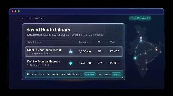
With route planning software from Fleet Scanner, build multi-stop routes using your own saved geofence points like depots, client locations, checkpoints and toll points. Then choose the best route based on fastest time, shortest distance, or no tolls. Before sending a truck, you can already see distance, ETA, and toll cost. You can also save regular routes and get alerts if a truck leaves the planned path.
Get Free Demo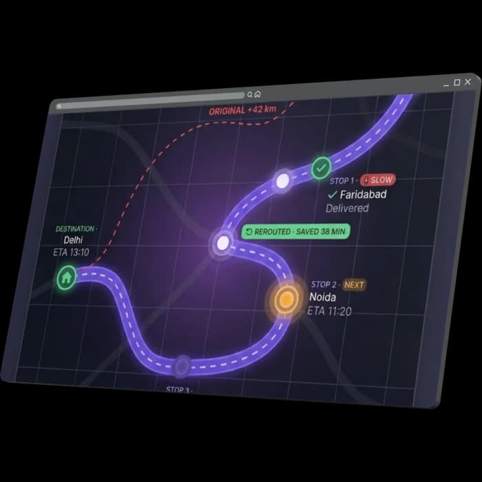
Every wrong turn wastes fuel, time, and causes late deliveries
When drivers decide routes on their own, the company loses money without noticing. Extra distance, avoidable tolls, missed stops, and unplanned delays all add up, and you only see the damage later in the bill. When you have many vehicles, this loss becomes very big.
Extra kilometres
Drivers sometimes take different roads than planned, which increases distance and fuel use without anyone tracking it.
Avoidable tolls
If toll-free routes are not planned, trucks end up paying extra toll charges that could have been avoided.
Missed checkpoints
When stops are not properly ordered, drivers may miss pickups or deliveries, causing delays and broken promises.
No trip costing
Without planning tools, you cannot know the real distance, travel time, or toll cost until after the trip is finished.
Plan the route, cost the trip, hold the line
Fleet Scanner creates routes using your saved geofence locations. It helps you choose the best path, shows full trip cost before dispatch, and keeps trucks on the correct route with live alerts.
Build routes from waypoints you already trust
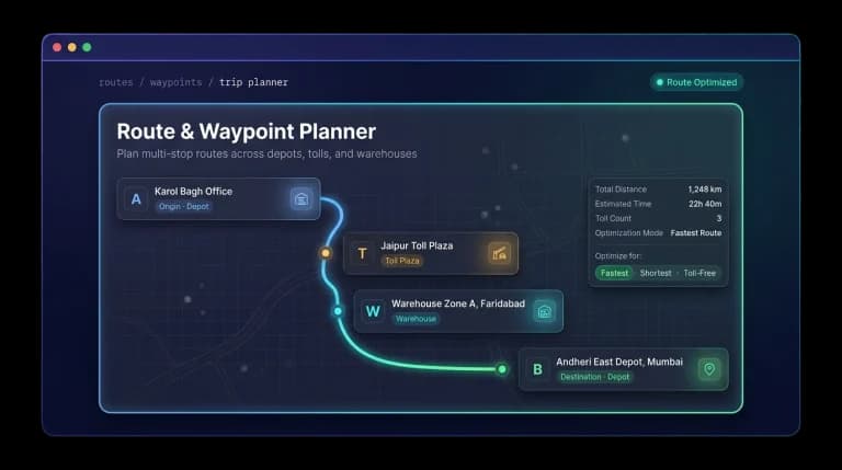
Routes are built using your saved locations, like depots, warehouses, client sites, toll points, checkpoints, and risky zones. You just pick a starting point, add stops in order, and set the destination. The system builds the whole route using places your team already knows.
- Start point → checkpoints → destination, all from saved zones
- Six types of stops: depot, client, warehouse, toll, checkpoint, hazardous area
- Easy multi-stop routing in just a few clicks
Fastest, shortest or toll-free your choice
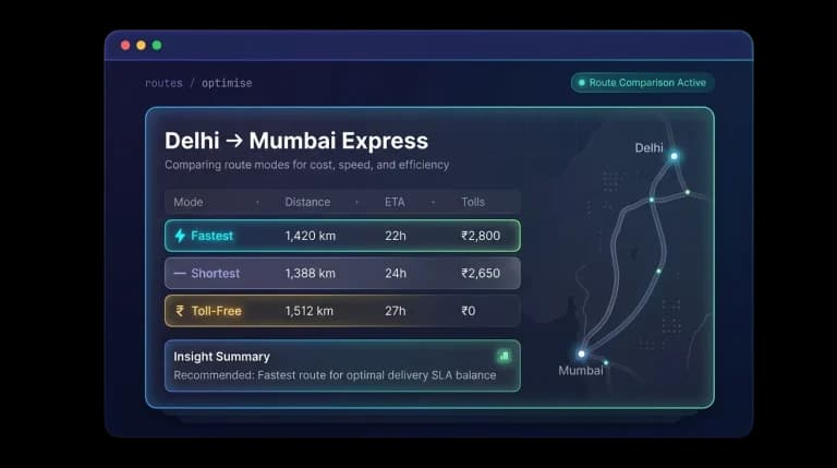
Every route can be optimized in three ways. Fastest gets you there quickest, shortest cuts down the distance, and toll-free helps you save money on tolls. You can switch between options and instantly see the updated distance, arrival time, and toll cost before you pick one.
- Fastest, shortest, and toll-free route options
- Updates instantly when you switch modes
- Pick the best option based on the customer and the cost
Know distance, ETA and tolls before you dispatch
Each route shows full details before the trip even starts, including distance, estimated arrival time, and total toll cost. This helps you set the right price, compare different routes, and plan realistic delivery times instead of guessing.
- Live distance, arrival time, and total toll cost
- Better pricing and route comparison
- Accurate delivery time planning before the trip begins
Keep every truck on the plan
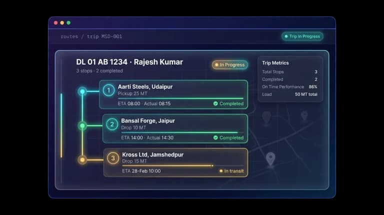
Once a trip starts, Fleet Scanner watches it in real time. If a vehicle leaves the planned route or misses a stop, you get an alert right away. For trips with multiple stops, each pickup and delivery is tracked in order, so you can compare the planned time against the actual time for every stop.
- Instant alerts for off-route driving and missed stops
- Odometer reading and total distance logged when a stop is completed
- Compare planned time vs. actual time for each stop
Less fuel, lower tolls, on-time deliveries
Cut fuel and distance
Smart route planning removes unnecessary extra driving and reduces fuel costs.
Lower toll spend
Toll-free routing helps avoid unnecessary charges across regular trips.
Hit delivery windows
Accurate ETAs and route control help you deliver on time more often.
Quote with confidence
You already know distance, time, and toll cost before the trip starts.
Stop off-route running
Alerts help you catch wrong turns and restricted zone entries immediately.
Never miss a stop
All pickups and drops are completed in the correct order without confusion.
From plan to dispatch to delivery
Pick waypoints
Choose origin, checkpoints & destination geofences.
Optimise
Fastest, shortest or toll-free.
Cost it
Review distance, ETA & tolls.
Dispatch
Assign route to a vehicle & driver.
Monitor
Deviation alerts & stop tracking live.
Everything You Need to Know
Simple answers to common questions about how route planning works in Fleet Scanner.
Get Free DemoWhat is route planning software?
Route planning software helps you create, optimize, and cost vehicle trips before sending them out. Fleet Scanner uses saved geofence locations to build routes, shows cost and time, and tracks trips with alerts.
How does route optimisation work?
It selects the best path based on fastest time, shortest distance, or lowest toll cost.
Can I plan multi-stop routes?
Yes, you can add multiple stops in order and manage full trip sequences.
Does it calculate toll costs?
Yes, it shows estimated toll charges before the trip starts.
What happens if a vehicle goes off-route?
You get an instant alert when the vehicle leaves the planned route.
Do I need new hardware for route management?
No, it works with your existing tracking setup.